Past Work
The Setup
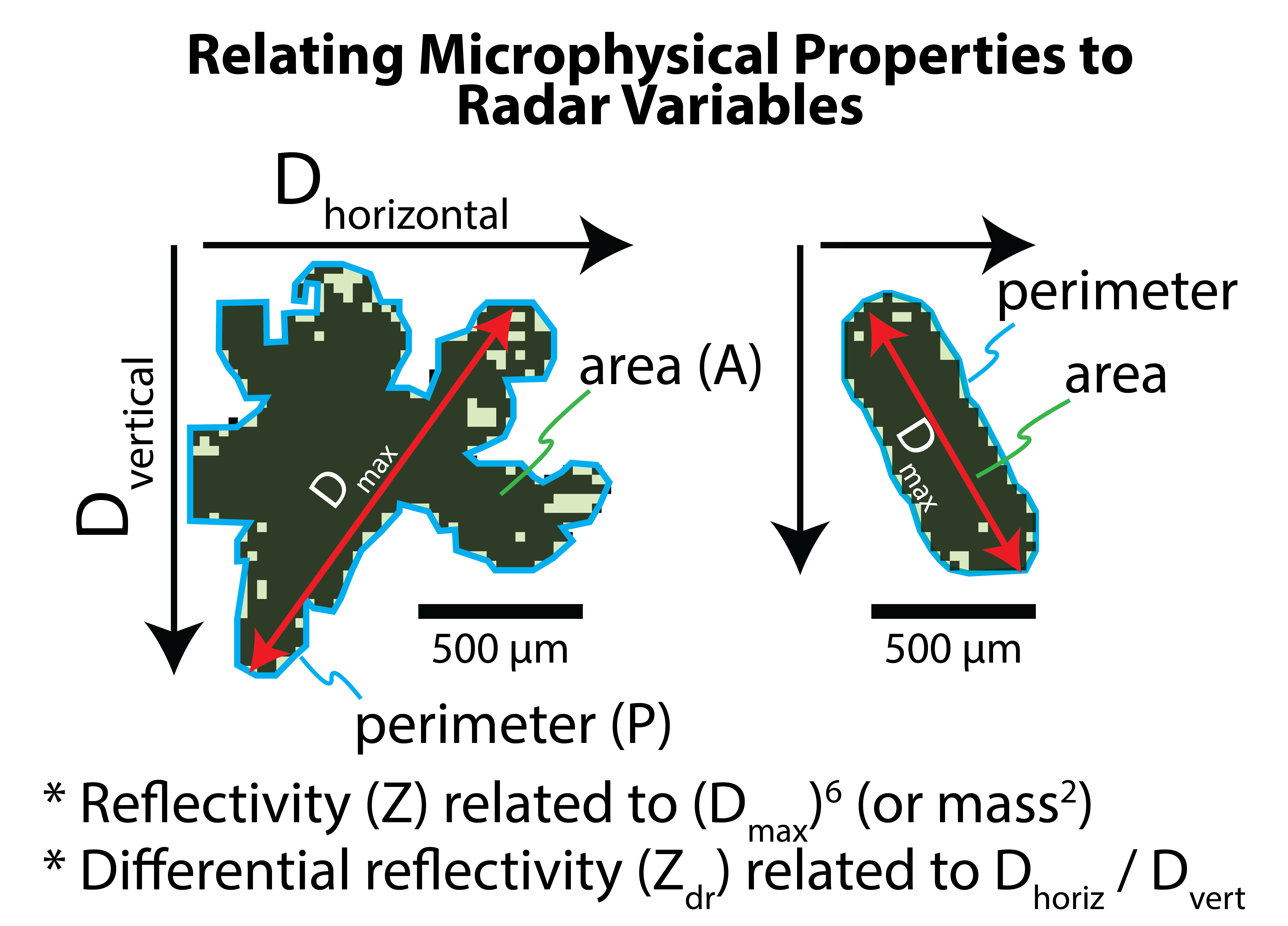
Hydrometeor Classification (HC) using ground-based radars identify the dominant particle type in a volume given electromagnetic properties transmitted at horizontal and vertical polarizations from the radar. HC algorithms today help researchers and forecasters understand the microphysical properties in the cloud and estimate snowfall and rainfall rates for a given location. However, these algorithms rely on the limited verification data available and our knowledge of polarization properties as it relates to particle properties (e.g., size, shape).
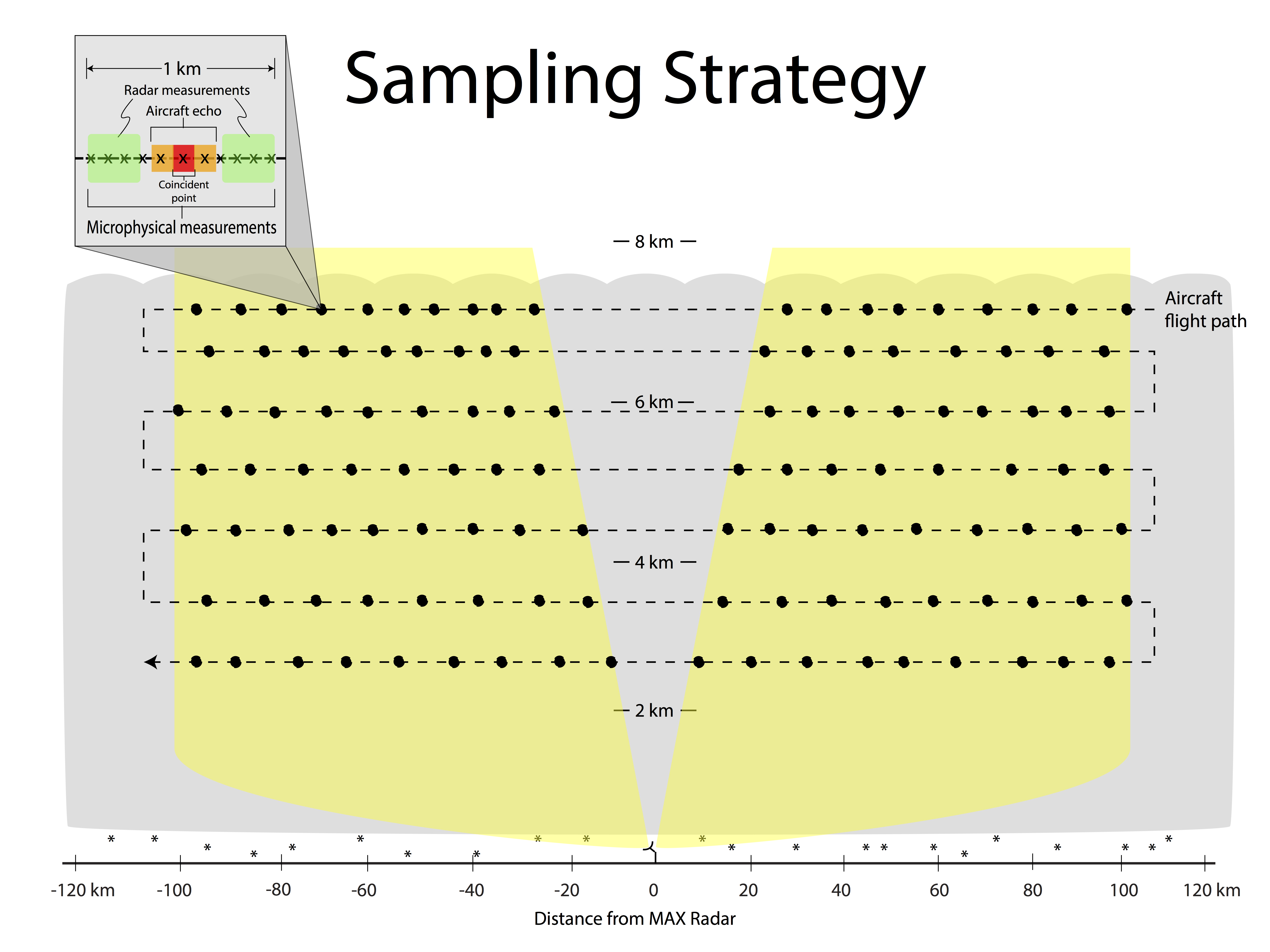
For some of the cyclones sampled during PLOWS, the National Science Foundation/National Center for Atmospheric Research (NSF/NCAR) C-130 aircraft flew over the same path as the Mobile Alabama X-band (MAX) dual-polarization Doppler Radar. This allowed the collection of reflectivity and dual-polarization variables coincident with in-situ cloud microphysical measurements.
The Results
-- I'm getting around to putting some interesting stuff here...please hang tight! --
Published findings on this research can be found on the AMS Publications site.