Site |
|
Latitude |
Longitude |
Alt. (ft) |
NWS Contact |
|
|
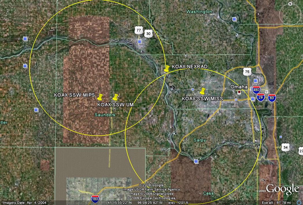
KOAX |
Omaha/Valley, NE |
41°19'13"N |
96°21'59"W |
1148 |
Dan Nietfeld |
(402) 359-5166 |
dan.nietfeld@noaa.gov |
MAX |
|
41°06'48.7"N |
96°33'47.6"W |
~1254 |
|
|
Along N-S gravel road
Note: altitude from Google Earth |
MIPS |
|
41°12'49.6"N |
96°41'52.4"W |
1288 |
|
|
Relatively open, along gravel road |
UM |
|
41°12'49.4"N |
96°37'18.7"W |
1197 |
|
|
Wahoo, NE Heritage Inn: may be difficult for sondes, but only usable motel nearby |
MISS |
Hampton Inn Omaha-Lakeside |
41°14'10.1"N |
96°11'22.7"W |
1192 |
|
|
Better view than Holiday Express, but limited parking |
MISS alt. |
Holiday Inn Express Omaha-West |
41°13'54.2"N |
96°11'30.4"W |
1164 |
|
|
|
 Bob
Rauber
University of Illinois
Bob
Rauber
University of Illinois