Site |
|
Latitude |
Longitude |
Alt. (ft) |
NWS Contact |
|
|
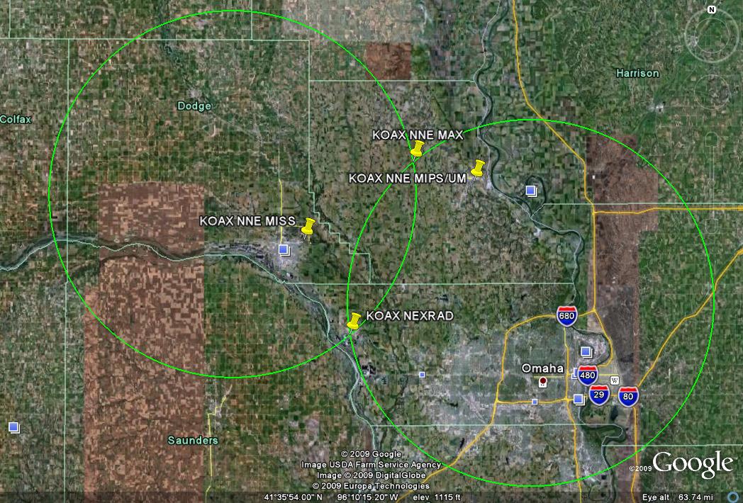
KOAX |
Omaha/Valley, NE |
41°19'13"N |
96°21'59"W |
1148 |
Dan Nietfeld |
(402) 359-5166 |
dan.nietfeld@noaa.gov |
MAX |
|
41°34'2.1"N |
96°14'44.8"W |
1336 |
|
|
|
MIPS/UM |
Blair Super 8 |
41°32'19.4"N |
96°07'48.3"W |
1050 |
|
|
Blair, NE Super 8 with open gravel lot. Only usable hotel locally. |
MISS |
Fremont Oak Tree Hotel |
41°27'20.8"N |
96°27'14"W |
1190 |
|
|
Very open site, paved dead-end road past hotel |
MAX alt. |
|
41°34'9.7"N |
96°13'56.8"W |
1342 |
|
|
Near primary site, use as backup if first is inaccessible |
MIPS alt. 1 |
|
41°25'58.9"N |
96°07'11"W |
1309 |
|
|
Santa's Woods tree farm (Scott Lund, manager @ 660-9138 cell; call 426-5250 if no answer). Good location, may need to park on rear access roads if farm is busy. Call Scott ahead of deployment. |
MIPS alt. 2 |
|
41°26'57.6"N |
96°07'30.8"W |
1316 |
|
|
In Blair, NE gated subdivision parking lot. Good location but only use as backup due to inaccessibility. |
MISS alt. 1 |
Fremont Holiday Inn Express |
41°27'16.9"N |
96°28'41.1"W |
1207 |
|
|
Dead-end road away from hotel |
MISS alt. 2 |
Fremont Sleep Inn |
41°28'13.9"N |
96°29'44.5"W |
1182 |
|
|
|
 Bob
Rauber
University of Illinois
Bob
Rauber
University of Illinois