Bob
Rauber
University of Illinois Bob
Rauber
University of Illinois
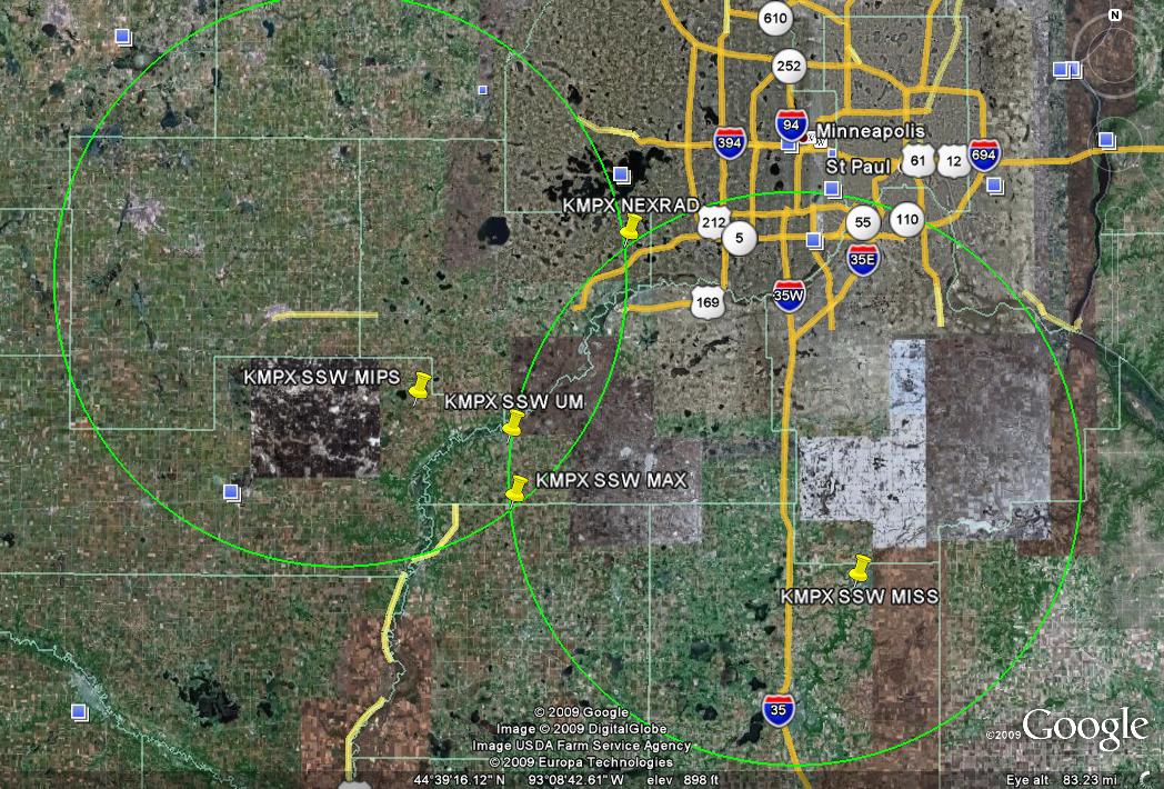
PLOWS SSW KMPX site coordinates and contact information |
Site |
|
Latitude |
Longitude |
Alt. (ft) |
NWS Contact |
|
|
KMPX |
Chanhassen, MN |
44°50'56"N |
93°33'55"W |
946 |
Tom Hultquist |
(952) 361-6670 |
thomas.hultquist@noaa.gov |
MAX |
Primary |
44°32'10.5"N |
93°45'25.4"W |
1010 |
|
|
Best location, should be able to park on east side of road |
MIPS |
|
44°39'32.2"N |
93°55'9.7"W |
1008 |
|
|
Park along west side of T-intersection, powerlines to east should be low enough. Otherwise can park along 206th St further east. |
UM |
Belle Plaine AmericInn |
44°36'53.4"N |
93°45'45.8"W |
885 |
|
|
Belle Plaine, MN Americ-Inn; should have usable clearance to SW. |
MISS |
Northfield Super 8 |
44°26'26.0"N |
93°10'59.0"W |
~930 |
|
|
|
MAX alt. 1 |
|
44°34'52.6"N |
93°50'12.9"W |
1055 |
|
|
Paved spur from US-169 if first site is inaccessible |
MAX alt. 2 |
|
44°35'42.7"N |
93°44'9.8"W |
1012 |
|
|
Backup location if other two are inaccessible, some blockage & water tower towards MIPS site |
MISS alt. |
Lakeville AmericInn |
44°42'03.3"N |
93°17'16.0"W |
~1007 |
|
|
|
|