Notes on Precipitation 10-6-04
General information on Precipitation
Types:
-
Rain: precip in the form of liquid
water drops that have diameters greater than drizzle drops
o Size
range à .5 mm
to 5 mm (the largest drop on record was discovered by Dr. Ken Beard, a
professor here in my department. It was 8 mm in diameter)
-
Drizzle: small water drops between 0.2
and 0.5 mm in diameter (smaller than rain drops)
o These
tend to fall slowly compared to raindrops and often obscure vision
-
Snow: solid (frozen) form of precip
that is composed of ice crystals in a complex (usually hexagonal) form
-
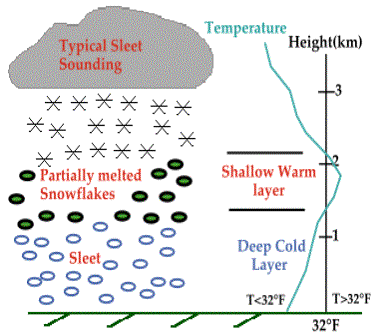
Sleet: frozen form of precip that
consists of semi-transparent ice-pellets of 5 mm diameter or less.
-
Freezing rain/drizzle: rain
or drizzle that falls in the liquid form and freezes upon striking a
cold object (i.e., a tree or your car) or the ground. Can produce a coating of
ice called glaze.
-
Graupel: ice pellets with size raging
from 2 – 5 mm in diameter that form in a cloud. They are created by a process
called accretion, which is the growth of a precip particle (usually ice pellet
or snow flake) by collection of super-cooled drops (liquid drops with temps
below 0°C) that freeze once
they contact the precip particle. These particles also contribute to the static
electricity build up that helps form lightning.
-
Hail: transparent or partially
opaque particles of ice that have a general size range of pea size to golf ball
size with some reaching 3-5 inches in diameter (baseball to grapefruit size).
The largest I have ever heard of happened last summer in a storm over Nebraska
where 7-inch diameter (~17-inch circumference) hail fell! That’s roughly the
size of a 16-inch softball.
-
Virga: any type of precip that falls
from a cloud but evaporates before it hits the surface
o Even
though the radar sees it, the station observation doesn’t report it. This is
because the radar beam is above the surface where the precip is while the
station is at the surface, which is below where the precip evaporated.
In terms of size range:
Cloud drop < drizzle
drop (freezing drizzle too) < rain drop (freezing rain
too), graupel, sleet < hail
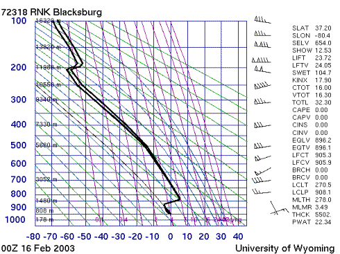
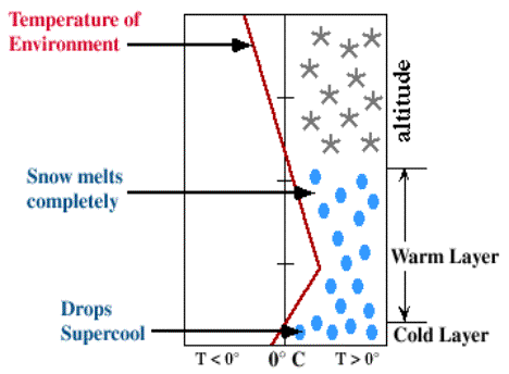
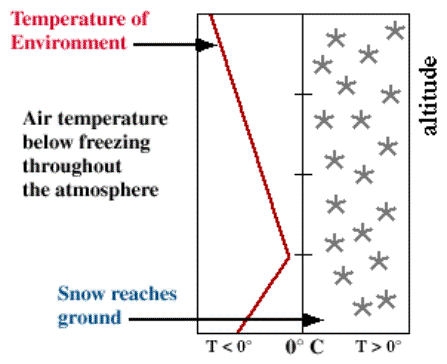
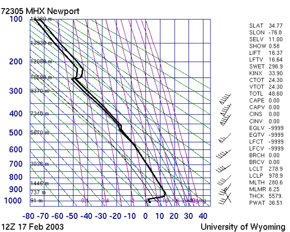
Precipitation type from soundings
SLEET

Freezing Rain
Snow
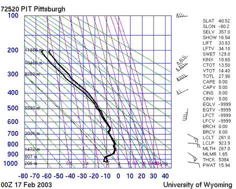
Rain
Radar
information
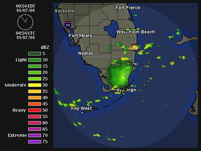
What is radar? Radar is a large antenna that
sends out microwave frequency energy waves. Microwave (with wavelength 2-15 cm)
are “sensitive” to precipitation sized particles in that when a microwave hits
a rain drop it will bounce off back to the antenna that sent it. The strength
of the “echo” is proportional to the size of the drop that reflects it. So,
larger drops create larger echoes. These echoes, or more commonly called
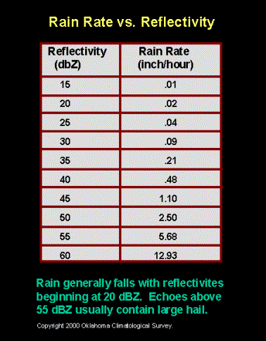
“reflectivity” have units of decibels (dBZ). The range of reflectivity values
indicates how heavy precipitation is. This range of reflectivity is usually
color coded so that heavy precip (i.e., thunderstorms) looks bright yellow to
reds and eventually to purples, while lighter precipitation starts in light
blues and moves toward dark greens as the precip becomes more moderate. One
major thing scientists can derive from radar is a precipitation rate (or
rainfall rate inches/hour). The larger the reflectivity value the greater the
rainfall rate.
A typical radar can “see” about 130 miles. In other
words a radar has a radius of about 130 miles.
NOTE: The radar can only “see” precipitation sized
particles. Any particles that are smaller (i.e., cloud drops) do not produce a
strong enough reflectivity for the radar to “see” them. Therefore, radar only
lets you know where it is precipitating, it does not tell you where clouds are!
(However, you can infer that where it is raining, there are clouds but if there
is no rain on the radar screen, that DOESN’T mean that there aren’t clouds.)